Territory

A land rich in history

The territory of Nuragus occupies part of the southern-center of the Sarcidano, closed in by the Giara of Gesturi, the mountains of Isili, the mountain of Santu Antine of Genoni and the Sarcidano plateau.

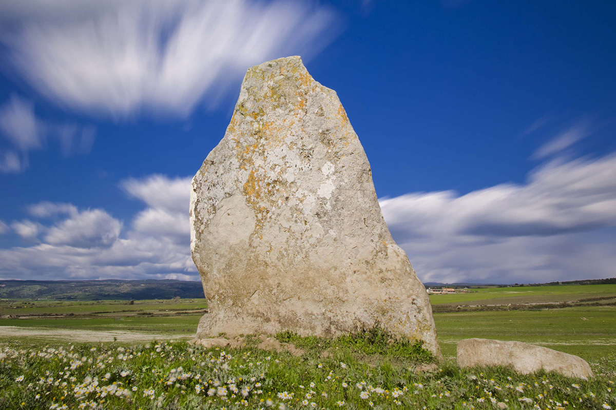
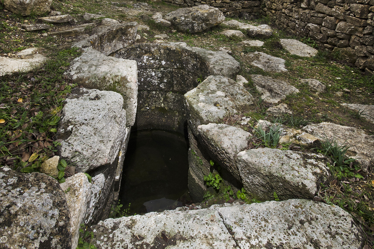
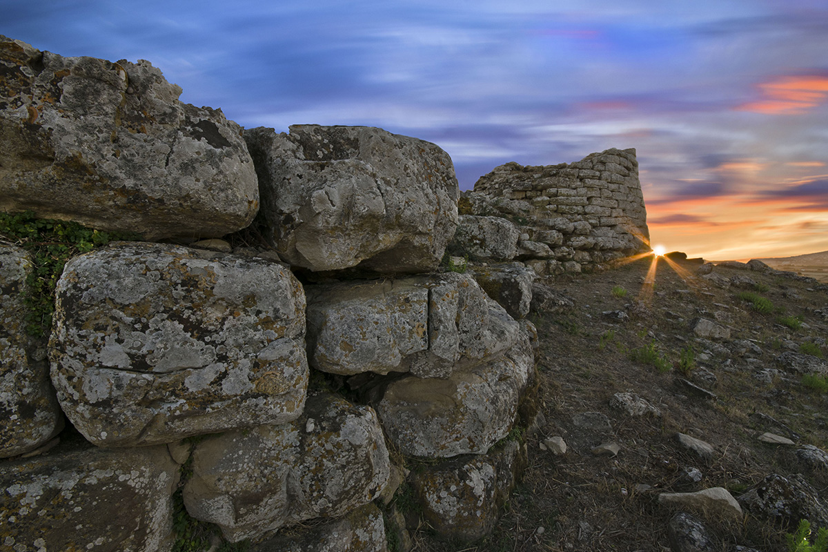
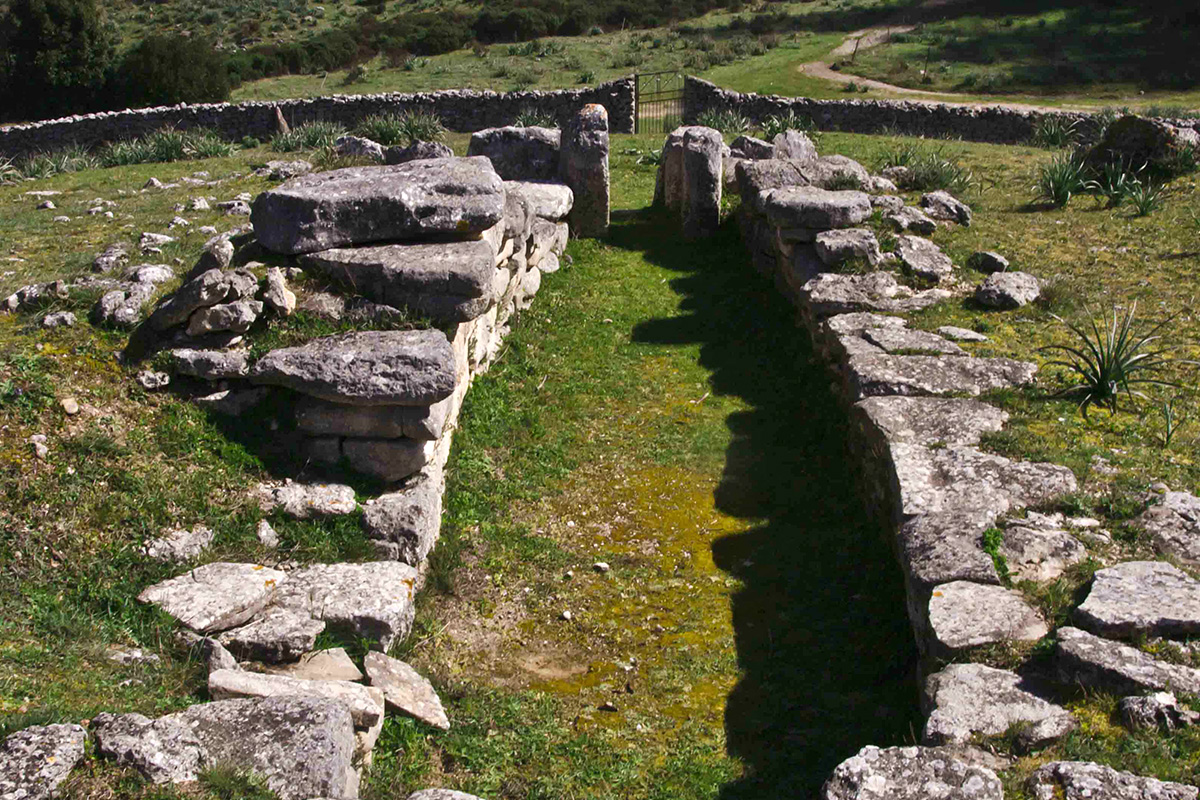
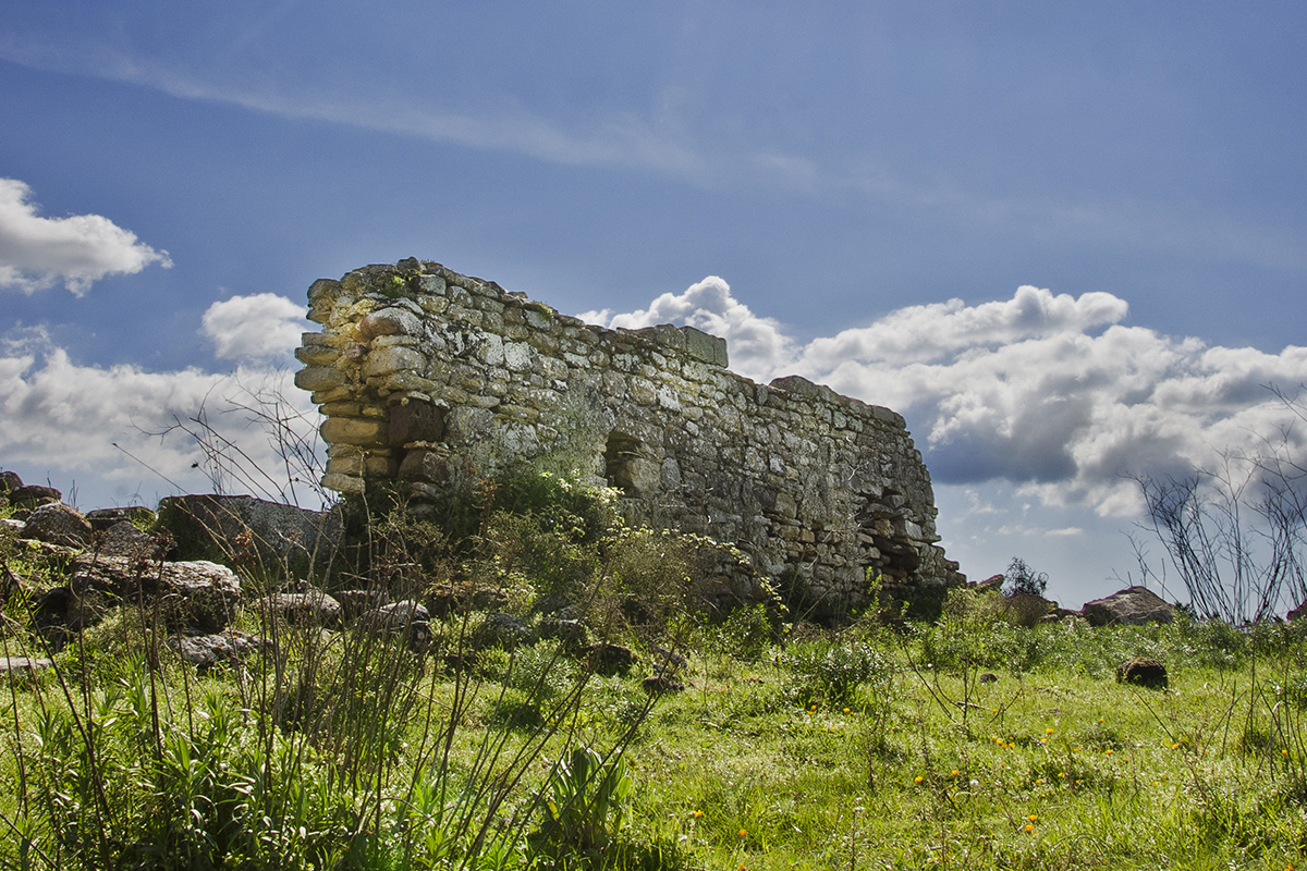
Since the Neolithic period this area has offered much of interest to the eye of the archaeologist. Testimony of an even more remote past are found in some of the Domus de Janas (like Pardilenza and Conca’e Ortu) a menhir (Sa Perda Fitta) and many monuments of the Nuraghic era, of which among these the most famous are the sacred well of Coni and the nuraghes of Santu Millanu and Valenza.

Menhir of Sa Perda Fita

Domus de Janas of Canali

Monuments of which a religious character is of significant importance, the sacred well of Coni was dug until the rock bed below and to find the water vein. The temple was built with blocks of basalt laid in an isometric style that formed a platform on a trapezoidal plane of different construction phases in the Nuraghic age and that of the late antiquity, exactly between the 10th century BC up until the period of conquest of the Roman empire. This place of water worship, which was annexed to the village protected by the nuraghe Santu Millanu, was certainly the object of many pilgrims, who would use it for domestic and religious use demonstrated by the artifacts in bronze forged from the nearby foundry of Forraxi Nioi.

Sacred well of Coni

On the other side, we have the nuraghe of Santu Millanu, one of the charms of the lovely countryside of Nuragus. It contains an inner tower that still possesses a good bit of original construction and with four angular towers still traceable today on the terrain. Surrounding the nuraghe we can still see remains on the south side of traces of the village with additional constructions dating back to the roman period.

The nuraghe of Valenza is one of the few examples of a five sided nuraghe on the island; the area comes of age and is intensely occupied from the nuraghic period until the Punic and Roman, which are easily identified in the abundant archaeological discoveries found on the site.

Nuraghe Santu Milanu

Ox-ide ingot found in 1857 at Serra Ilixi

Seeing that the fortress of S.Antine of Genoni was practically just a stone’s throw away, it was intensely frequented in the Roman and Punic period. Plinio and Tolomeo, in fact cited the location of Valentia on the road that connected Karales to Ulbia by the Mediterranean, meaning the road that went through the interior area of the island. The toponym of Valenza attests to the presence of agriculture of Nuragus in the memory of perhaps an older settlement, of which more so, there are still numerous remains where the medieval church of Santa Maria di Valenza was built. This area was investigated in the 1970s and in that initial exploration there were found different remains of wall building and fragments of objects like wooden chests and graves. The memory of Valenza was so present that the name given to the area contained between the villages of Nuragus and Coni was Valenza. An epidemic and a destructive event eventually was the cause of the decision to move the population from Valenza into the territory of the modern day town of Nuragus.

Giants Tomb of Aiodda, between Nuragus and Nurallao

Ruins of the church of Santa Maria di Valenza